CARTA DE NAVEGACIÓN COSTERA

Taxonomy

Code

Scope note(s)

Source note(s)

Display note(s)

Hierarchical terms

CARTA DE NAVEGACIÓN COSTERA

Equivalent terms

CARTA DE NAVEGACIÓN COSTERA

Associated terms

CARTA DE NAVEGACIÓN COSTERA

118 Archival description results for CARTA DE NAVEGACIÓN COSTERA

118 results directly related Exclude narrower terms

CHERBOURG TO CAP D´ANTIFER

Zona Geográfica: Francia costa norte
Costa norte de Francia con los puertos de Cherburgo y Le Havre

INSTITUTO HIDROGRÁFICO FRANCIA

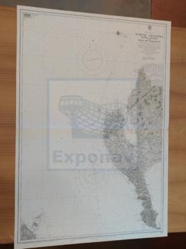
CAPE SIERRA LEONO TO TURTLE ISLANDS

Zona Geográfica: Costa oeste de África
Proximidades de Sierra Leona y Sherbo. Puerto de Freetown y las islas Banana y Tortuga

INSTITUTO HIDROGRÁFICO INGLATERRA

PRAWLE POINT TO HENGISTBURY HEAD

Zona Geográfica: Costa sur de Inglaterra
Tierras de Devonshire, Dorsetchire, Hampshire y la bahía Lyme

INSTITUTO HIDROGRÁFICO INGLATERRA

RIVER TYNE TO ST. ABBS HEAD

Zona Geográfica: Costa este de Inglaterra
Tierras de Northumberland, mar del Norte y el río Tyne

INSTITUTO HIDROGRÁFICO INGLATERRA

SHETLAND ISLES

Zona Geográfica: Islas británicas
Islas Shetland (Mainland, Yell y Unst)

INSTITUTO HIDROGRÁFICO INGLATERRA

FIRTH OF SOLWAY

Zona Geográfica: Costa oeste de Inglaterra
Aparecen las tierras de Cumberland, Dumfries y Kirkcudbright.

INSTITUTO HIDROGRÁFICO INGLATERRA

ISLAND OF ISLAY

Zona Geográfica: Costa oeste de Escocia
Aparecen las islas de Islay y Jura; bahía de Laggan

INSTITUTO HIDROGRÁFICO INGLATERRA

Results 81 to 90 of 118